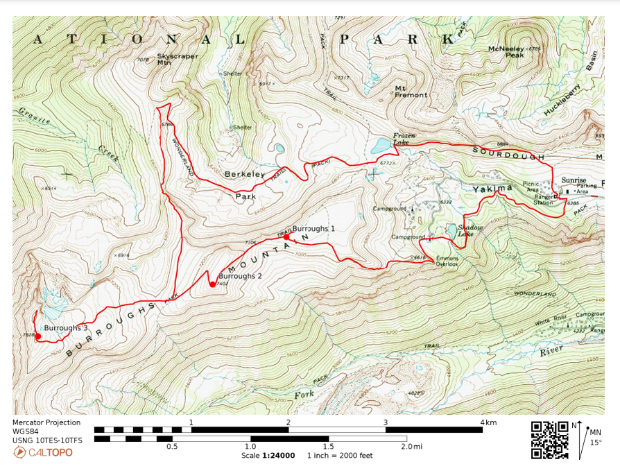
Burroughs Mountains Loop Hike in Mount Rainier
Mount Rainier National Park
|
|
For about a year I'd had the Burroughs Mountain Trail on my Mount Rainier to-do list. When scouting it out on the map for a hike this summer, I decided to take it up a notch! Why do an out and back to Burroughs Mountain when I could make it into a larger loop hike with more varied terrain? Studying the map further I made a plan to connect 4 different trails together, starting and ending at the Sunrise Visitor Center base in Mount Rainier. The kicker was an off-trail section in the middle of the route (which I'd read a trip report on), to connect one side of the loop to the other side. In the end, my plan went perfectly! Beautiful scenery every step of the way and couldn't stop smiling!
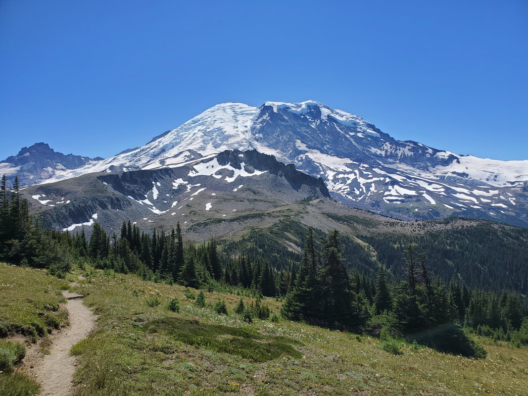
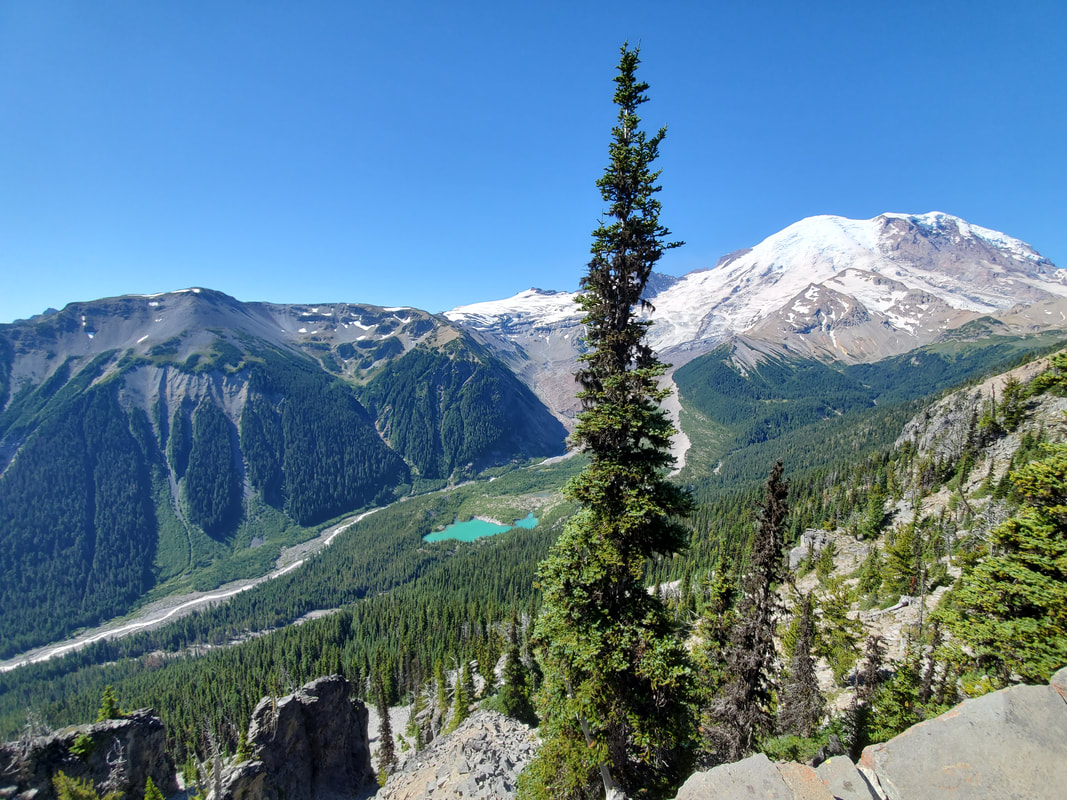
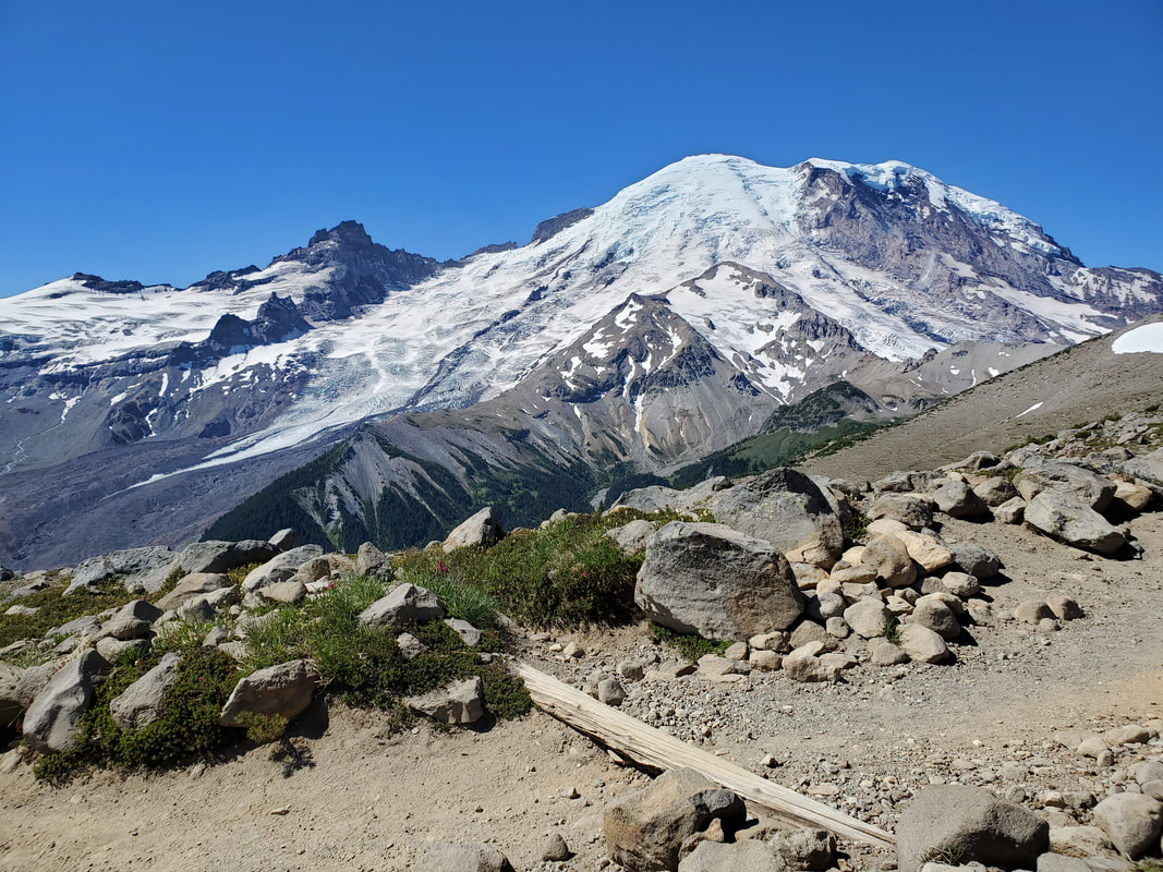
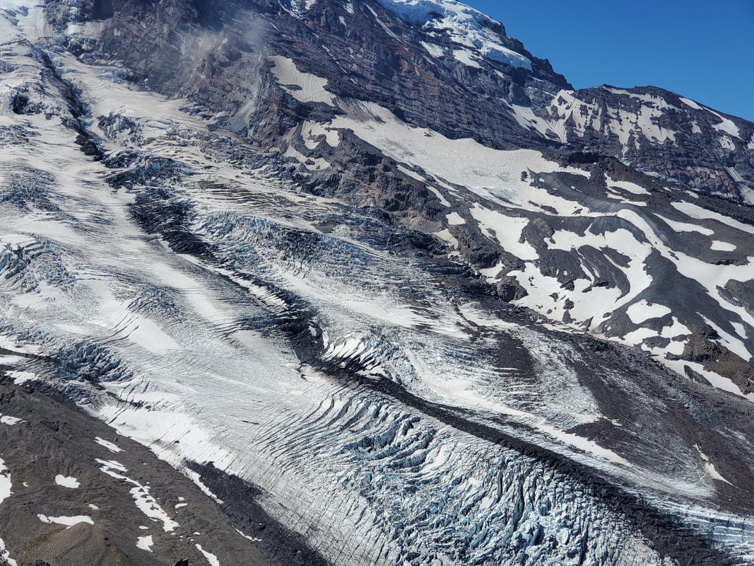
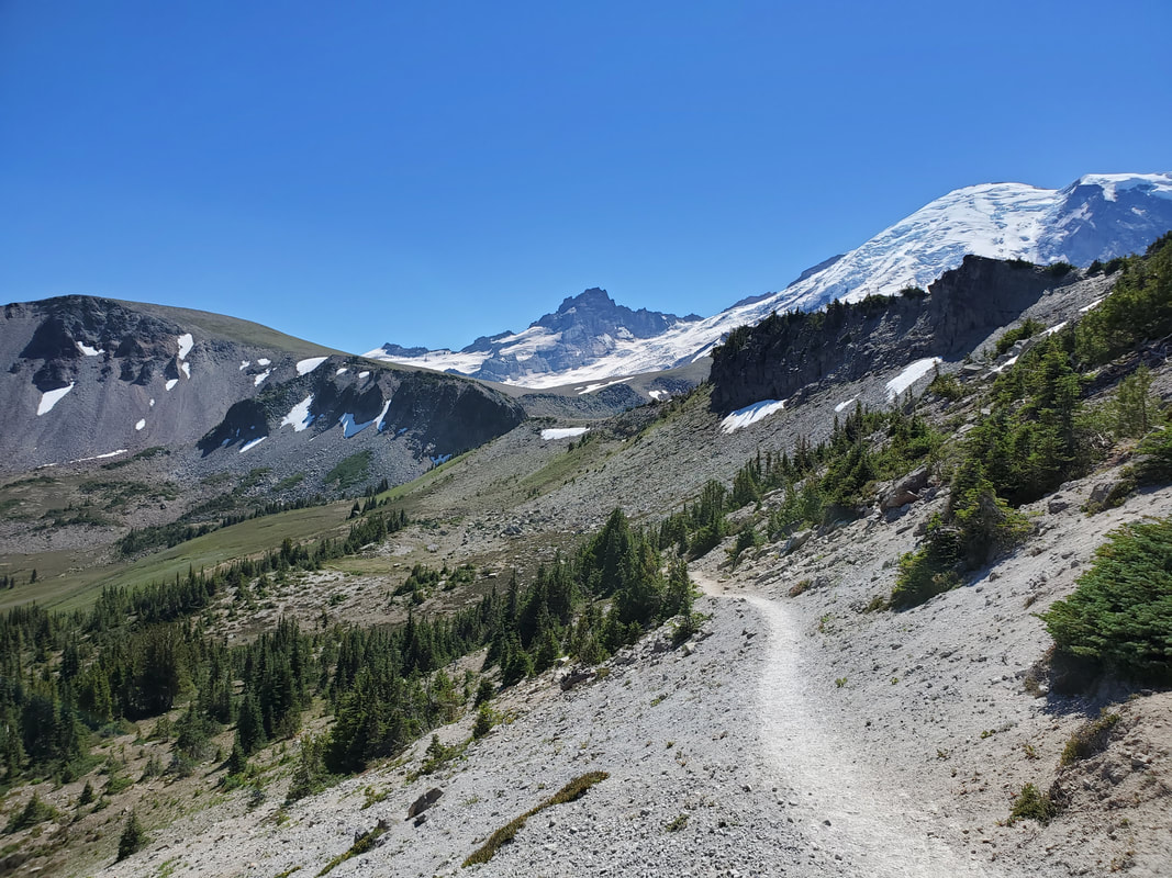
I started out mid-morning on a bluebird sky day from Sunrise, hiking on the Sunrise Rim Trail. This part of the trail provides nice views of the Emmons glacier and moraine. Emmons is the largest of Mount Rainier's 24 named glaciers and has carved a valley, extending far out from the mountain, feeding a lake with turquoise glacial water. The trail sneaks along the top of the valley wall for awhile before climbing up a few hundred feet of elevation to connect with the Burroughs Mountain Trail.

|
|
|
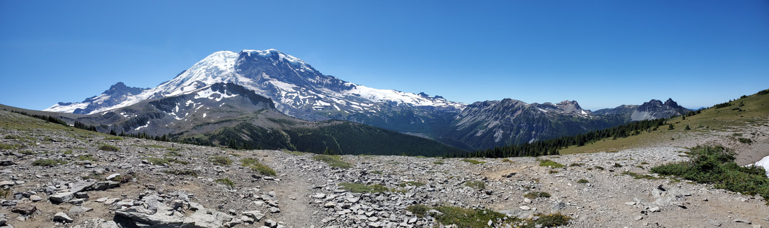
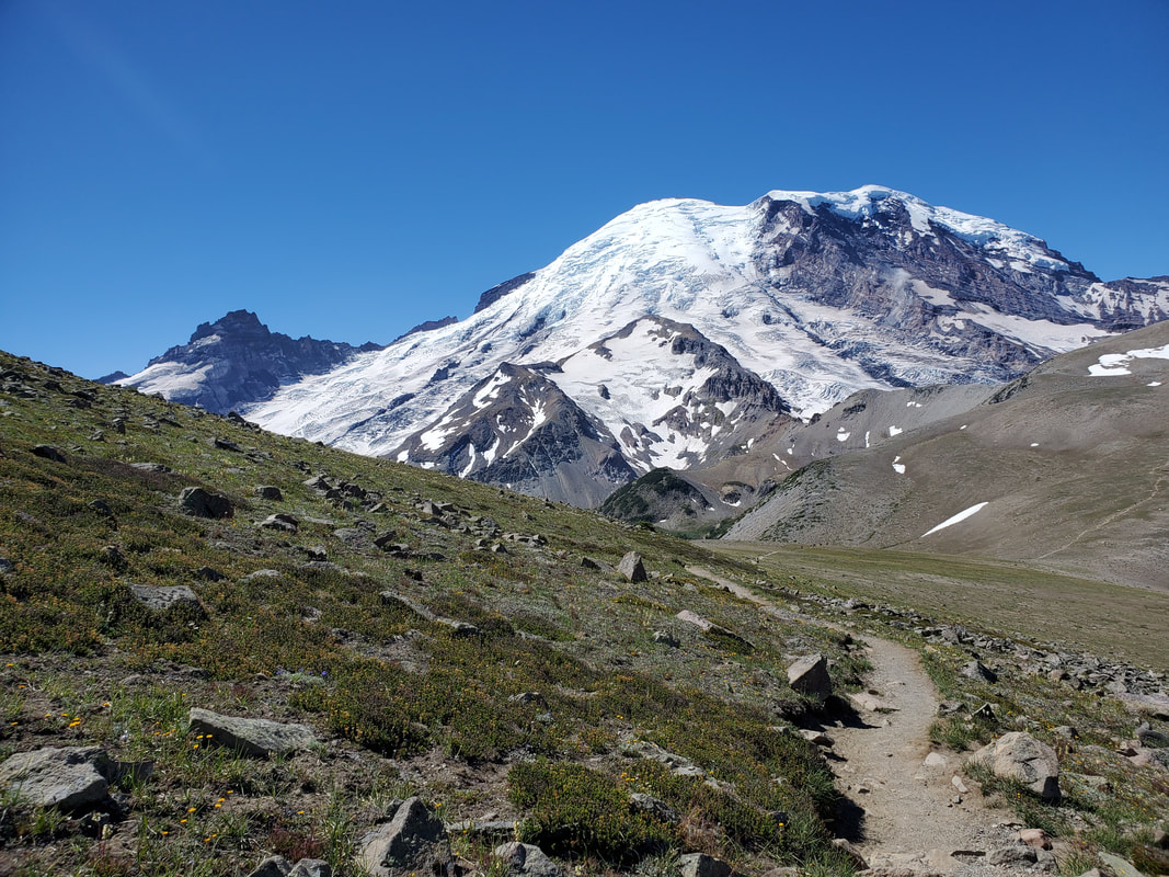
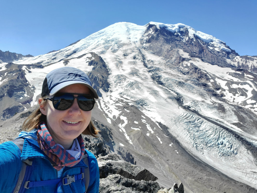
Burroughs Mountain Trail runs along a ridgeline to 3 separate mountain "peaks" - Burroughs 1, 2, and 3. The 3rd mountain tops out at 7,800 feet and gets you close enough to check out Mount Rainier's glaciers and crevasses. The environment on all 3 mountains is barren and exposed, described as a tundra-like alpine mountain. After reaching the ridgeline at Burroughs 1 it is an uphill climb to reach the 2nd Burroughs. The official trail ends here, but an unofficial boot path continues up a significant incline to the 3rd and final Burroughs.

|
|
|
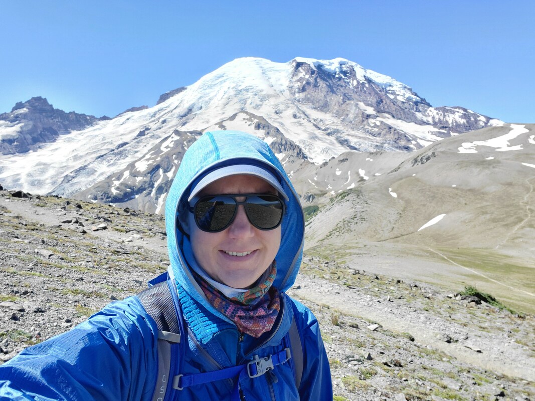
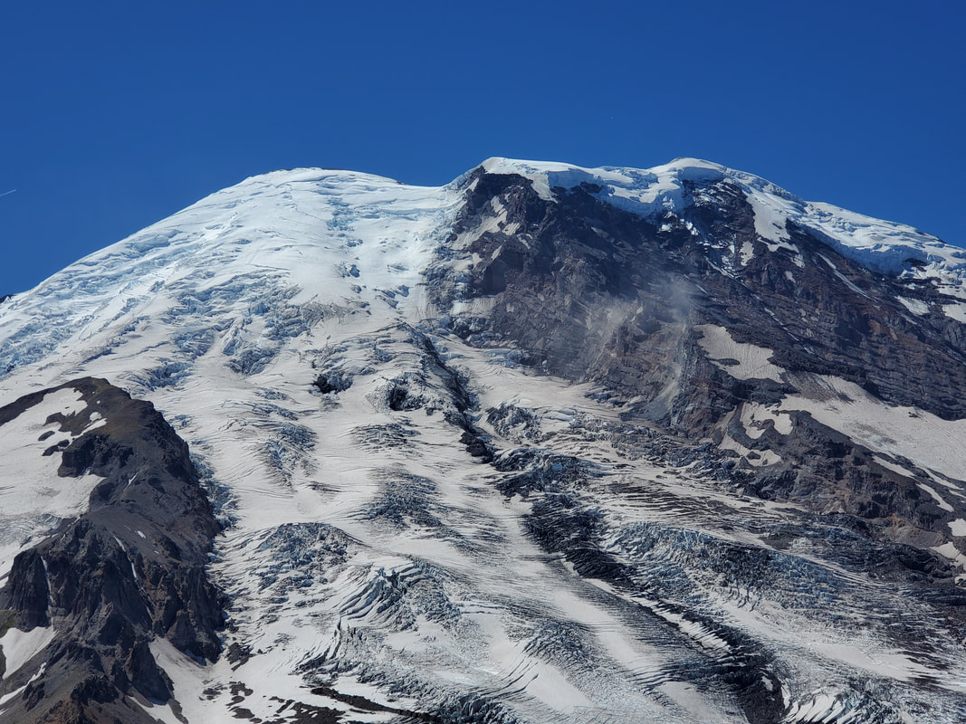
The view from the top of the 3rd Burroughs is spectacular. Mount Rainier is in your face. I studied the crevasses and even heard ice crashing down off the mountain. I sat at the top of Burroughs 3 for awhile, taking my lunch break and enjoying the 360 degree views of mountain peaks as far the eye can see.
|
|
|
|
|
|
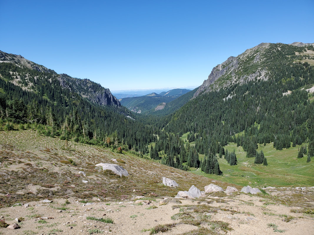
After descending down Burroughs 3, it was time for the off-trail section. The route was fairly obvious looking at the land, but I practiced using my map/compass and Gaia GPS app on my phone to navigate. I found the access point and headed out onto a plateau area between several other ridges and towards my connection with the Wonderland Trail. I came across a beautiful valley with stream below and crossed through a meadow-like area before successfully connecting up to the trail. I took my time during this section and enjoyed the moments knowing that few people ever saw the view from where I walked.

|
|
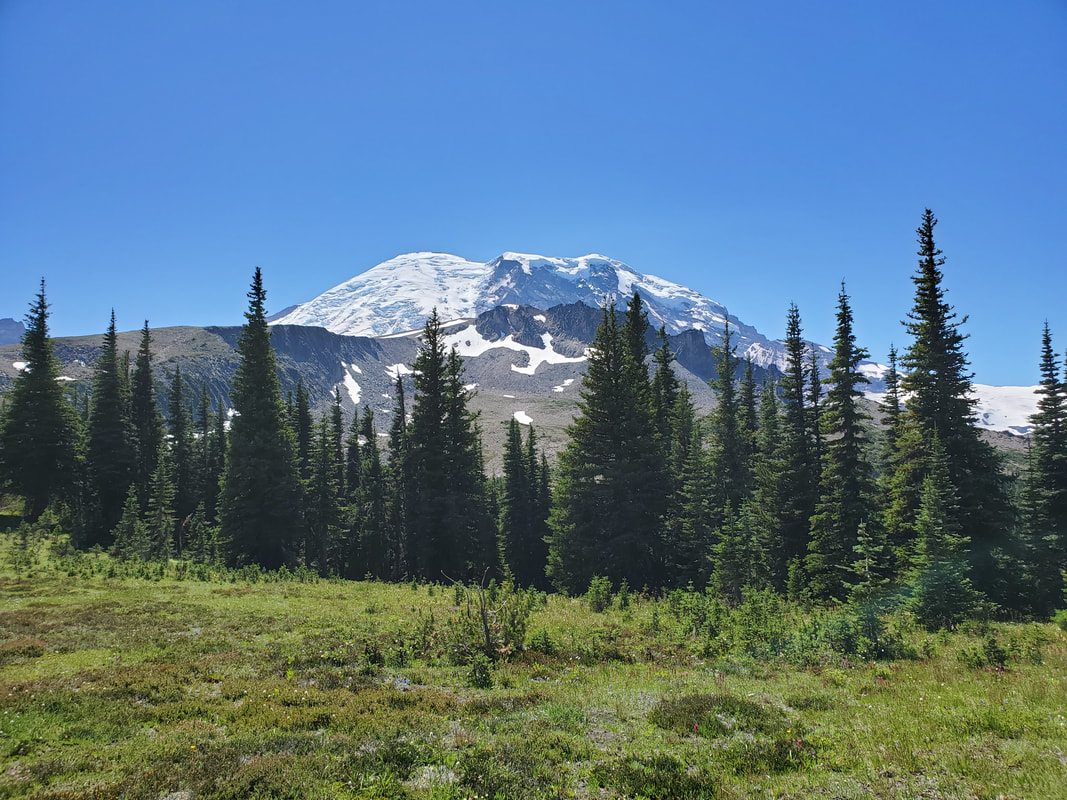
Once connected to the Wonderland Trail (a 93 mile trail which encircles Mount Rainier) I headed through Berkeley Park, a lush, green valley environment. Finally, I connected to the Sourdough Ridge trail and back down into the Sunrise Visitor Center to finish off a fantastic day!
|
|
|
|